Geotechnical Drilling and Its Significance
Introduction
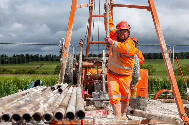
Geotechnical drilling serves as a vital pillar in the fields of civil engineering and geology. It plays a pivotal role in comprehending the hidden aspects of the Earth's subsurface, providing essential insights and data for a wide range of construction projects and geological investigations. By exploring the depths of the ground, geotechnical drilling aids in assessing soil properties, identifying rock characteristics, and evaluating the geological conditions that underpin the safety, stability, and success of various endeavors, making it an indispensable tool for engineers and geologists alike
1. Borehole Drilling
Borehole drilling is a method of creating vertical or inclined holes (boreholes) in the Earth's surface, typically for the purpose of exploring and analyzing the subsurface layers of soil, rock, and other geological formations. These boreholes are often small in diameter and can extend to significant depths below the ground surface. Borehole drilling involves the use of specialized equipment to excavate and extract samples of the subsurface materials, providing valuable data for various applications.

Role in Subsurface Exploration:
The primary role of borehole drilling in subsurface exploration is to uncover essential information about the geology and geotechnical properties of the Earth beneath the surface. This information is crucial for several reasons:
Site Characterization: Boreholes help engineers and geologists characterize the soil and rock layers, including their composition, density, and mechanical properties. This information is vital for designing foundations, tunnels, and other infrastructure projects, as it influences construction techniques and the choice of materials.
Geotechnical Analysis: Borehole drilling allows for the collection of soil and rock samples, which can be analyzed in laboratories. This analysis helps assess the suitability of the ground for specific engineering projects and provides critical data for stability and settlement analyses.
Groundwater Exploration: Boreholes can be used to explore groundwater resources. By drilling into aquifers and conducting tests, it's possible to determine the availability, quality, and sustainable yield of groundwater, which is essential for water supply and environmental management.
Environmental Assessment: Borehole drilling can be part of environmental assessments. It helps in the sampling and analysis of subsurface materials to evaluate potential contamination, assess the impact of pollution, and monitor underground storage tanks or waste disposal sites.
Mineral Exploration: In geology, boreholes play a significant role in mineral exploration. Drilling can reveal the presence of valuable minerals and resources, which is essential for the mining industry.
2. Types of Drilling Methods
a. Rotary Drilling
Rotary drilling is a highly versatile method used to create boreholes in the Earth's subsurface. This technique involves the use of a rotating drill bit, which cuts through various materials, including soil, rock, and sediments, to create a cylindrical hole. Rotary drilling is known for its adaptability, making it suitable for a wide range of geological conditions and depths. The drill bit is attached to the bottom of a drill string, which rotates and penetrates the ground. It can operate at different angles, including vertical and inclined boreholes, and is used extensively in various applications within geotechnical engineering, environmental assessment, mineral exploration, and more.

Versatility and Applications:
Geotechnical Investigations: It is commonly used in geotechnical studies to assess subsurface conditions for construction projects, such as buildings, bridges, and dams. Rotary drilling provides valuable data about the composition, strength, and stability of the soil and rock layers.
Mineral Exploration: In the mining industry, rotary drilling is used to explore and identify mineral deposits. It aids in assessing the quantity, quality, and location of valuable resources like coal, ore, and precious metals.
Environmental Sampling: Rotary drilling is crucial for environmental assessments. It helps extract soil and groundwater samples, which are then analyzed to evaluate contamination, monitor hazardous waste sites, and assess soil and groundwater quality.
Water Well Drilling: Rotary drilling is widely used for the construction of water wells. It helps access underground aquifers and ensures a sustainable supply of clean groundwater for drinking and irrigation.
Oil and Gas Exploration: In the oil and gas industry, rotary drilling is used in the exploration and extraction of hydrocarbons. It can drill deep into the Earth's crust to access oil and gas reservoirs.
Scientific Research: Researchers and scientists employ rotary drilling in various scientific investigations, including studies related to geology, climate, and paleontology.
Key Components of Rotary Drilling Equipment:
Rotary drilling equipment consists of several critical components:
Drill Bit: The drill bit is the cutting tool that penetrates the subsurface material. It can be made of materials like tungsten carbide or diamond, chosen based on the hardness of the material being drilled.
Core Barrel: This component holds and extracts core samples obtained during drilling. It is crucial for geotechnical investigations where undisturbed samples are required.
Drill String: The drill string consists of drill rods and tubes that transmit rotary motion and force from the drilling machine to the drill bit.
Drilling Fluid: A fluid, often a mixture of water and additives, is used to lubricate the drill bit, carry cuttings to the surface, and provide stability to the borehole.
Challenges and Limitations:
Despite its versatility, rotary drilling has some challenges and limitations:
Difficulty in Certain Materials: It may struggle with materials like gravel, boulders, and fine sands below the water table due to erosion by the drilling fluid, leading to reduced recovery rates.
Limited Depth: Rotary drilling is generally limited to depths of around 100 meters for geotechnical purposes. For deeper drilling, specialized equipment or methods may be required.
Complex Subsurface Conditions: The presence of hard rock layers, caverns, or fault zones can pose challenges for rotary drilling, necessitating the use of alternative drilling methods.
Environmental Considerations: The use of drilling fluids raises environmental concerns, particularly in situations where contamination is a risk
b. Auger Drilling
Auger drilling is a drilling method that involves the use of an auger, which is a helical screw-like tool, to create boreholes in the Earth's subsurface. The auger, resembling a large corkscrew, rotates and cuts into the ground, extracting the drilled material to the surface. This drilling technique is particularly well-suited for drilling in relatively soft and cohesive soils. Auger drilling can be done manually for shallow depths or by using powered equipment for deeper boreholes.

Where Auger Drilling is Suitable:
Auger drilling is suitable for various applications, especially in geological and geotechnical investigations, as well as environmental assessments:
Preliminary Site Surveys: Auger drilling is often used for preliminary soil investigations and initial subsurface exploration. It helps determine the basic characteristics of the soil profile, such as its composition and consistency.
Environmental Sampling: Auger drilling is valuable for collecting soil samples to assess soil quality, identify contamination, and monitor environmental conditions in areas with potential soil or groundwater issues.
Shallow Boreholes: Auger drilling is well-suited for creating shallow boreholes, typically up to 40 meters deep, making it appropriate for applications like soil sampling, groundwater monitoring, and the installation of smaller-diameter monitoring wells.
Manual vs. Power Auger Drilling:
Manual Auger Drilling:
- Manual auger drilling involves physically turning the auger by hand. It is suitable for shallow boreholes (typically up to 2-4 meters) and smaller-diameter holes (2-5 centimeters).
- This method is more labor-intensive and is often used for quick and simple preliminary surveys to assess the soil's characteristics.
- It is portable and does not require significant machinery or power sources.
Power Auger Drilling:
- Power auger drilling employs motorized equipment to rotate the auger. It is suitable for deeper boreholes, often extending up to 40 meters, and larger-diameter holes (7-20 centimeters).
- Power auger drilling is more efficient and faster than manual drilling. It is commonly used for deeper soil sampling and environmental assessments.
- It is well-suited for applications that require precision and efficiency, especially when working at greater depths.
Hollow and Flight Augers and Their Advantages:
Hollow Augers:
Hollow augers are designed with a central opening that allows undisturbed soil samples to be extracted directly from the borehole without having to bring the flight (auger's helical section) to the surface.
The presence of a central casing in the hollow auger, ending in a small drill bit at the auger's head, allows the collection of undisturbed samples from specific depths.
Advantages:
- Ideal for environmental assessments and geotechnical investigations where the preservation of undisturbed samples is crucial.
- Reduces the potential for contamination between soil layers.
Flight Augers:
Flight augers are solid augers with a continuous helical flight, and the soil cuttings are brought to the surface with the auger itself. These augers are commonly used for general soil exploration and preliminary surveys.
Advantages:
- Simplicity and ease of use make them suitable for quick soil assessments and shallow boreholes.
- Cost-effective and portable.
The choice between hollow and flight augers depends on the specific drilling objectives and the need for undisturbed samples. Hollow augers are favored when precise, undisturbed samples are required, whereas flight augers are more convenient for simpler, shallower investigations where speed and cost-efficiency are priorities.
c. Percussion Drilling
The principle behind percussion drilling involves the repeated impact of a heavy hammer on a series of steel tubes or casing pipes that are sequentially driven into the ground. These impacts result in the penetration of the soil or rock layers. The number of blows needed to advance each section (typically 20 centimeters) is counted systematically. The density and resistance of the soil or rock encountered dictate the effort required to drive the casing pipes.
Applications of Percussion Drilling:
- Percussion drilling is used to assess the subsurface conditions for construction projects, including determining the bearing capacity of the soil and identifying potential foundation issues.
- It is particularly effective for drilling in cohesive soils (such as clays) that are difficult to penetrate with other methods.
- Percussion drilling provides valuable information for soil classification, which is essential for engineering design and construction.
- The method is also employed for environmental assessments, including monitoring underground storage tanks and assessing soil contamination.
Use of Steel Tubes and a Hammer:
In percussion drilling, the drill string consists of a series of steel tubes or casing pipes with varying diameters. These tubes are driven into the ground, with each section being hammered by a heavy, mechanically operated hammer. The hammering action forces the steel tubes into the soil or rock layers. As the drilling progresses, the individual sections are added to extend the depth of the borehole.
The casing pipes serve multiple purposes:
- They provide structural support and reinforcement for the borehole, preventing wall collapse.
- They protect the sample from contamination as it is retrieved from the borehole.
- The hammer transfers energy to the casing pipes, causing them to penetrate the ground.
Depth Limitations of Percussion Drilling:
Percussion drilling is generally suitable for creating boreholes with depths ranging from approximately 15 to 40 meters. The depth limitations depend on factors such as the consistency of the subsurface material, the size and weight of the hammer, and the capabilities of the drilling equipment. Beyond these depths, percussion drilling may become less efficient and practical, and other drilling methods may be preferred for deeper exploration.
3. Determining the Number and Depth of Boreholes
Deciding the number and depth of boreholes is a critical aspect of any subsurface investigation, and it plays a pivotal role in the success and reliability of the data collected. This decision-making process is influenced by various factors, including the project's scope, objectives, and the specific conditions of the site. Let's explore the importance of this decision and the key factors that influence it:
Importance of Deciding the Number and Depth of Boreholes:
- Boreholes are essential for obtaining accurate and representative data about the subsurface conditions. The number and depth of boreholes must be carefully determined to ensure that the collected data adequately represents the entire project area.
- The collected geotechnical and geological data from boreholes are critical for engineering design and construction. Incorrect or insufficient data can lead to design errors, project delays, and cost overruns.
- Determining the depth of boreholes is crucial for assessing the influence of the subsurface on the safety and stability of structures. Inadequate data can result in poor foundation design and potential risks to human safety.
- For environmental assessments, the correct number and depth of boreholes are crucial for evaluating contamination, groundwater quality, and potential environmental risks. Inadequate data may lead to inadequate remediation efforts.
Factors Influencing the Decision:
Several factors influence the determination of the number and depth of boreholes:
- The scope of the project, whether it's a small building or a large infrastructure project, impacts the number and depth of boreholes required. Larger projects may necessitate a more extensive investigation.
- The specific objectives of the project influence the type and quantity of data needed. For example, a dam construction project requires extensive subsurface information to ensure stability.
- The geological and geotechnical characteristics of the site, including soil and rock types, groundwater conditions, and geological formations, play a significant role in determining the number and depth of boreholes.
- Environmental regulations, safety standards, and local building codes may dictate the minimum requirements for borehole investigation, often based on the project's scale and purpose.
- The budget allocated for the investigation may limit the number and depth of boreholes. It's essential to balance data collection with budget constraints.
- Complex projects with unique subsurface challenges, such as urban development on brownfields, may require more extensive drilling to mitigate risks.
- The level of uncertainty regarding subsurface conditions influences the extent of the investigation. In uncertain or variable conditions, more boreholes may be needed.
- Existing data, if available, can guide the decision-making process. Previous investigations and historical records can provide valuable insights into subsurface conditions.
- Geotechnical and geological experts can provide guidance on the appropriate number and depth of boreholes based on their experience and knowledge of local conditions.
4. Presentation of Borehole Data
The systematic presentation of data collected during borehole investigations is essential for clear communication, analysis, and decision-making in various fields, including geotechnical engineering, environmental science, and mineral exploration. The presentation of data follows a structured format to ensure that critical information is accurately conveyed. Here's how borehole data is systematically presented:
- A data table is typically the core element of borehole data presentation. It includes detailed information organized in rows and columns. Commonly included data in the table are as follows:
- Depth intervals of the borehole, indicate at what depths specific data is recorded.
- A description of the subsurface materials encountered, including soil types, rock types, and any noteworthy features or variations.
- Information about soil and rock samples obtained during drilling, including sample type, color, texture, moisture content, and any laboratory test results.
- Relevant geotechnical properties such as soil density, shear strength, and consolidation properties.
- Information about groundwater levels, water quality, and flow characteristics.
- Any additional data, such as temperature, pressure, or gas concentrations, depending on the project's specific objectives.
- Borehole data may be supplemented with graphical representations, such as depth vs. geotechnical properties (e.g., shear strength profiles), groundwater level vs. depth, or lithological logs. These visual aids enhance the understanding of subsurface conditions and trends.
- Photographic documentation of the borehole, samples, and notable features can be included to provide a visual context for the data. Photographs are particularly useful for illustrating key observations.
- If multiple boreholes are part of the investigation, their locations may be plotted on a map, and cross-sections can be created to illustrate the subsurface characteristics in a horizontal or vertical profile.
- Supplementary information, such as laboratory test reports, geological maps, well installation details, and any relevant project-specific data, may be included in appendices.
Adoption of Standardized Methods:
The presentation of borehole data often adheres to standardized methods to ensure consistency and comparability across projects. These standards are widely recognized and adopted in various regions. Two examples of commonly used standards are:
ASTM D2488:
This standard by the American Society for Testing and Materials (ASTM) provides guidelines for describing soils, rock, and unconsolidated materials encountered in boreholes. It offers a standardized method for recording geological descriptions and classifying soils.
Eurocode 7:
Eurocode 7, a European standard, offers guidance for geotechnical investigations, including borehole data presentation. It outlines standardized procedures for reporting geotechnical data, making it easier to interpret and compare data from various projects.
Adherence to these standards ensures that data is presented in a consistent and understandable manner. It facilitates the exchange of information among professionals and helps in decision-making processes related to engineering, construction, and environmental assessments.
5. Key Parameters in Geotechnical Drilling
a. Rock Quality Designation (RQD)
Rock Quality Designation (RQD) is a quantitative measure used in geology and geotechnical engineering to assess the quality and integrity of rock core samples obtained during drilling. It plays a crucial role in evaluating the suitability of rock formations for various engineering and construction projects, especially in tunneling, mining, and dam construction. RQD provides insights into the extent of fractures, joints, and weathering within a rock mass.
Calculation:
To calculate RQD, you divide the total length of sound or intact rock core pieces within a rock sample by the total length of the sample. The result is usually expressed as a percentage.

Interpretation:
The interpretation of RQD values typically follows these guidelines:
- High RQD (e.g., 75% or greater): A high RQD indicates that a significant portion of the core sample consists of sound rock material. This suggests good rock quality with fewer fractures and joints, making it suitable for engineering projects that require stable rock support.
- Moderate RQD (e.g., 50-75%): A moderate RQD value indicates a rock mass with some fractures, joints, or weathering. While not ideal, it can still be suitable for certain engineering applications with appropriate support measures.
- Low RQD (e.g., less than 50%): A low RQD value suggests that the rock core contains a substantial amount of fractures, joints, or weathered material. Such rock may be challenging for engineering projects, and additional support or reinforcement may be necessary.
Implications:
The implications of different RQD values include:
- High RQD values generally indicate stable and high-quality rock masses that require minimal additional support.
- Moderate RQD values suggest the presence of some fractures or joints but may still be manageable with appropriate engineering solutions.
- Low RQD values signal significant rock discontinuities, potentially necessitating extensive support measures to ensure safety and stability in engineering projects.
b. Core Recovery:
Core recovery is a critical parameter in geotechnical and geological drilling. It measures the percentage of rock or soil core obtained from a borehole relative to the total length of the borehole drilled. Core recovery is essential for determining the quality and reliability of the samples collected during drilling operations.

Core recovery is calculated by dividing the length of the recovered core (the usable portion) by the total length of the borehole and expressing it as a percentage.

High core recovery percentages indicate that the borehole samples are relatively undisturbed and can provide accurate information about subsurface conditions.
Low core recovery may indicate that a significant portion of the sample is missing or disturbed, which can affect the reliability of geological or geotechnical data. It can lead to incomplete or inaccurate data, making it challenging to assess the subsurface conditions accurately.
Significance of High Core Recovery Percentages:
- High core recovery percentages are significant because they:
- Provide representative and reliable data for geotechnical and geological investigations.
- Ensure that the collected core samples accurately reflect the subsurface conditions, reducing uncertainty in engineering design and construction.
- Facilitate better decision-making in construction, mining, tunneling, and other projects by offering a more comprehensive understanding of the rock or soil properties.
Comments
Post a Comment